Used some maps and planned a new, shorter version of the earlier Mt Dandenong walk. Basically the best bits and hence the name. Today was the day to walk it to see how it goes.
Had a great time. However, it became pretty clear that my ‘shortcut’ back to the car (Glasgow Track – see below) was so steep that it really wouldn’t have been enjoyable had others been with me. Here’s a Google Earth image, showing the walk. Note the height exaggerated by 2 for impact:
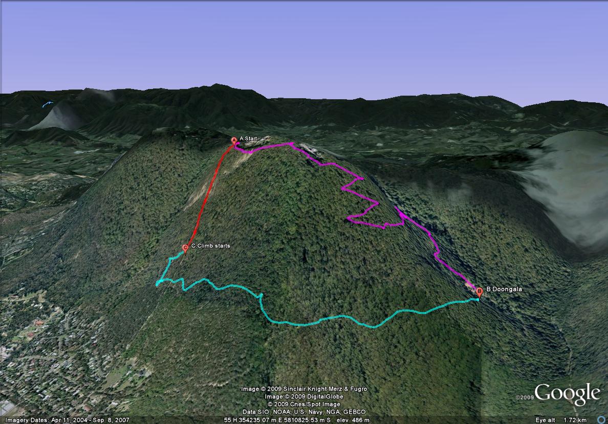
A) Car is here near Kyeema cairn (Melways 66 E-1)
(pink line) Along the top and then a zig zag down to
B) Doongalla site (66 D-5), lunch/break then explore this great area and then along…
(aqua line) almost level along the front of the mountain until…
C) The Climb (red line). Straight up the front of Mt Dandenong on Glasgow Track. Wow. I’m told this is used by those preparing for Kokoda. (update: and here’s some further info on this) Rocky, dirt, mud in places. No polite zig zags to ease the gradient.
To give you some idea, these are direct from the GPS and not exaggerated by 2:
Pink line 2.3 km long and descends 280 metres
Red line 0.5 km (500 m) long and ascends 200 metres.
If you look you can see that Glasgow Tk continues down the mountain; seems to merge with Glasgow Road. And yes, I missed it whilst on the aqua line bit. It has no signs and is only about 1 metre wide or less. I had a map and was able to loop back and pick it up at point C.
Mmm. Need to think more about how to get back from Doongalla to the car. Maybe just double back.
Anyway here’s the Google Earth file to explore in 3D.
<Oct 4th 2009>
Where computers [still] meet people