“QGIS is a free and open-source cross-platform desktop geographic information system application that supports viewing, editing, printing, and analysis of geospatial data” aka it let’s me make cool maps. Been a bit of a learning curve, but nothing too heavy. I’ve had some direct email help from an excellent local mapmaker, for which I am very grateful.
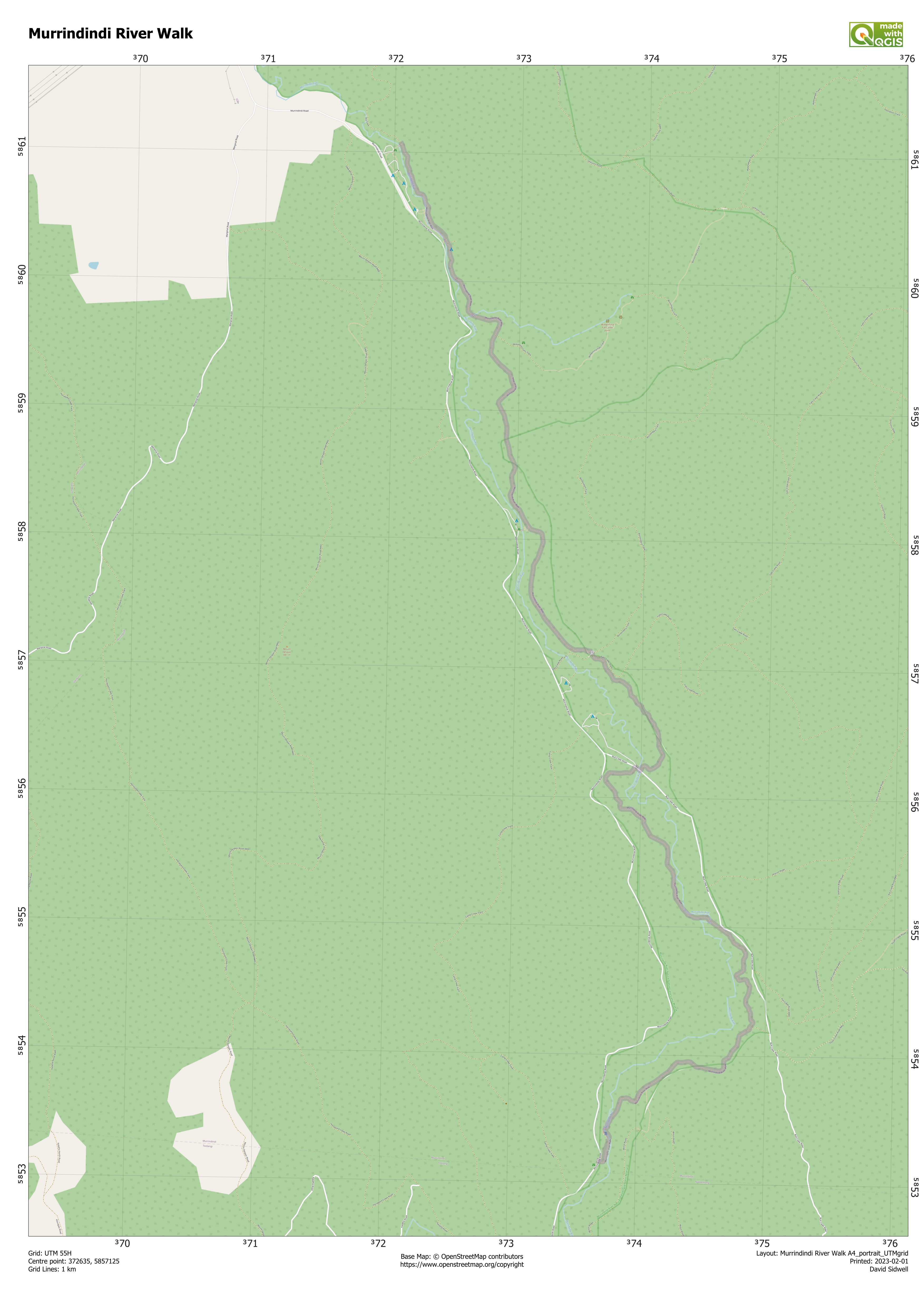
I stick to UTM for my maps. It’s one of the many projections which are used to ‘make’ the very 3D (sorta) sphere of the Earth fit onto a flat bit of computer screen…or paper 🙂 It’s fine for ‘human level’ maps, like hiking. But I don’t think you see sailors, pilots et al using it for their day jobs. It’s not in degrees, but is a grid in meters. So not only can you use to to get your position (X,Y) but also to see – and estimate – distances. To that end, my maps usually have a printed grid of 1000 m, aka 1 km. Here’s a recent example:
All of this – the software and the underlying map/data – are from legally free sources. Not only that, but you can easily create a geo-referenced PDF; one that has the coordinates stored within in it. You can then use that with software like Avenza and navigate without an internet connection.